A look back in time ...
-
The geology of the Creek 53 watershed
The Creek 53 watershed is within an ecoregion known as the St Lawrence Lowlands. This area is the lands and waters that border the Ottawa and St Lawrence Rivers. It is highly populated, with some of Canada’s largest cities in the region including Montreal, Ottawa, and Quebec City. Much of the region is devoted to agriculture, whether cultivated farmland or dairy. The forests of the areas are largely characterized as ‘mixed wood’ (hardwoods and softwoods), and wetlands are common in addition to the larger rivers, flowing to the ocean.
The ecosystems we see today in the St. Lawrence Lowlands are all a product of the region’s geological past. While geology is often about long periods of time – ancient history, with moving continents – more recent history, notably glaciation, has very much defined the region. The Creek 53 watershed and the broader regions has been shaped significantly by time scales of tens of thousands of years.
Older landforms are still present in the region, of course, and very visible! Mount Rigaud, for example, is made of ancient igneous rocks, and is estimated at 720 million years old – certainly the oldest visible landscape feature in the region. Prominences like Oka, Mount Royal, and the rest of the Monteregian Hills are youngsters in comparison: these igneous intrusions were formed 100 to 140 millions years ago. But what is between those hills, and where most of the people live, the bulk of agriculture in the region, and other elements of the landscape are very young, at least on a geological time scale. -
-
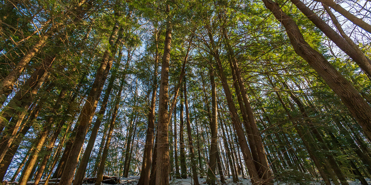
The last glacial maximum was about 18,000 years ago, and during this period the St Lawrence Lowlands was covered by ice that was one or more kilometers thick. As these glaciers retreated, this left immense marks on the land, and various kinds of deposits, in various kinds of ridges and hills. These are generally well-drained deposits, often with sandy or sand-loam soils. In present day you often see clumps or rows of naturally occurring eastern white pine trees along these ridges: this coniferous tree species prefers its roots to be in well-drained conditions.
-
-
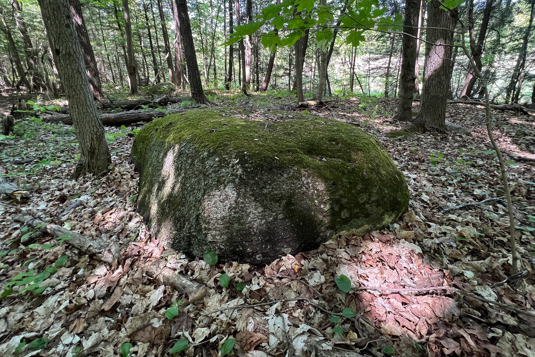
“Glacial Till”, which is a mixed bag of deposits strewn across parts of our landscape, includes all kinds of rocks, of all kinds of shapes and sizes. For some farmers in the region, these were a headache and meant back-breaking work as they had to be removed as the land was prepared for cultivation. In many cases these rocks were piled up to form neat fences or rows between fields, or to delineate a property.
-
-
The glaciers of 18,000 years ago were, of course, immensely heavy, and contained simply unimaginable amounts of water. We are still feeling the impacts of the weight of this glacier – our present-day earthquakes in the Montreal region are the ‘re-bounding’ of our continent from the past weight that was upon it, from the glacier – this is called ‘isostatic rebound’, and still causes our world to shake. Our earthquakes are the ongoing impacts of the last great glaciation.
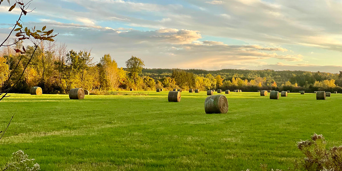
As the glaciers retreated, and as the world warmed, the ice melted and giant bodies of water were established. The weight of all the water on land also meant that the oceans flooded in to meet this freshwater. In eastern Ontario and Western Quebec, this was the Champlain Sea. This vast body of water impacted the soils of the region, and the bulk of the St. Lawrence Lowlands is the marine clay deposits formed by this ancient sea. These soils drain poorly, and can quickly become saturated, and their ability to retain water, and their flatness (‘lowlands’) is what is now prime agricultural land throughout the Montreal area – whether on the Island of Montreal (e.g., the farmlands of Macdonald Campus), near St. Clet, or where one can see fields of sunflowers, soybean, or corn on the drive towards the Ontario-Quebec border from Montreal.
The Champlain Sea created diverse landscapes beyond just saturated clay lowlands. Sandy beaches formed along its shorelines as water levels rose and fell over thousands of years, creating deposits at different elevations. Montreal's Plateau-Mont-Royal neighbourhood was named for one of these ancient plateaus formed by the retreating Champlain Sea. The area was formerly a beach of the Champlain Sea. From Mount Royal, you can visualize these ancient shorelines as a series of step-like plateaus descending to today's St. Lawrence River. The neighbourhood's distinctive flat topography compared to surrounding areas is a direct result of these ancient geological processes, where the retreating sea left behind these well-drained sandy beach deposits at different elevations.
These sandy beach soils drain well, making them ideal for specific agricultural uses like apple orchards, which can be found on the Monteregian Hills (including Oka and Mount St. Hilaire). These well-drained soils are preferred by apple trees and pines, whose roots cannot tolerate the waterlogged conditions of the clay lowlands.
The division between ancient clay-deposits from the Champlain Sea, and the sandy deposits (from either the sea’s beaches or the glacial deposits) is never perfect nor easily delineated, hence why in towns such as Hudson, some areas of the town have clay-dominated soils, and others are sandy. The former have weeping fields easily saturated compared to others! Some people may be able to grow apple trees or have a small orchard, but the limits of such will be eventually delineated by the underlying soil types.
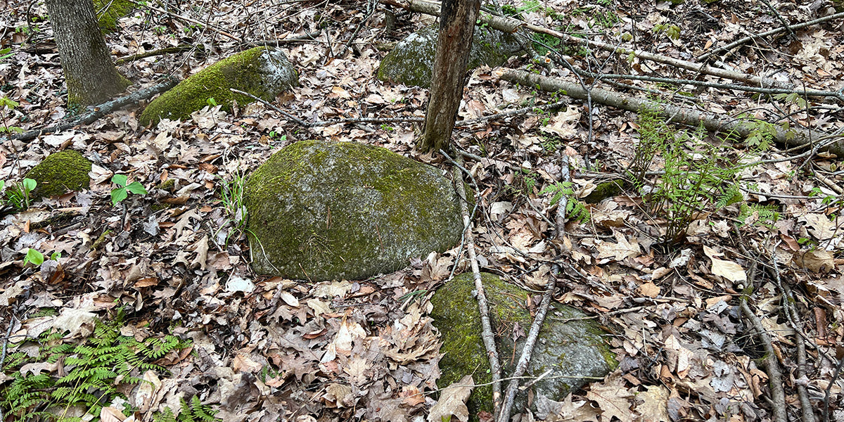
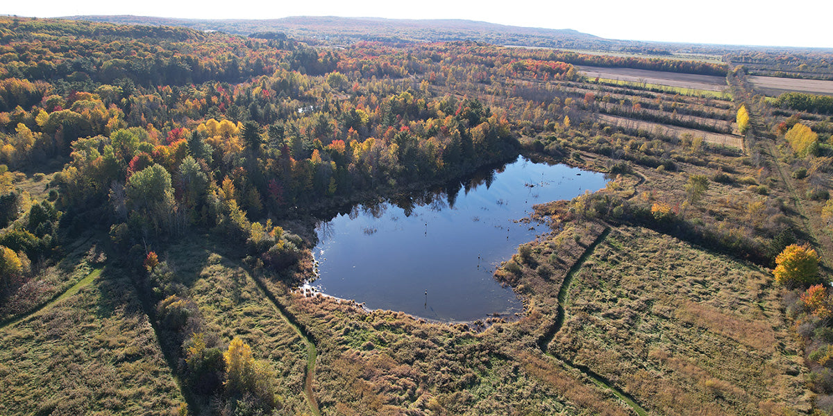
At the properties protected by the Creek 53 Conservancy Trust, these geological events are clearly visible – the ‘Hudson Escarpment’ is a ridge left when the glacier retreated. The glaciers left behind a jumble of rocks that can be seen today along parts of the ridge and occasionally at the base as well as in some forested areas. The standing water in the lower elevation areas of the protected properties are found in the more clay-rich areas, and the agricultural lands closer to the Ottawa river are the ancient seabed itself. -
-
Over time the glacier continued to retreat, and one can imagine the ice scraping across the top and sides of Mount Rigaud – many of these lines are visible in the rocks of the mountain. Massive rivers formed along the side of Mount Rigaud, rushing downstream, with waterfalls, immense pressure, and channeling perfectly through the land. This wild and strong current impacted and shaped the rocks and created shorelines now long gone, with the rounded stones of the “champ de patates” (near the Shrine of our Lady of Lourdes) as an example of this past. It’s a visible and fascinating area to witness.
Eventually the glaciers fully retreated, and the present-day Ottawa river was formed to the north and east of the Creek 53 watershed, and the Great Lakes and St Lawrence River system formed to the south, with both river systems draining the water from the continent’s interior. -
-
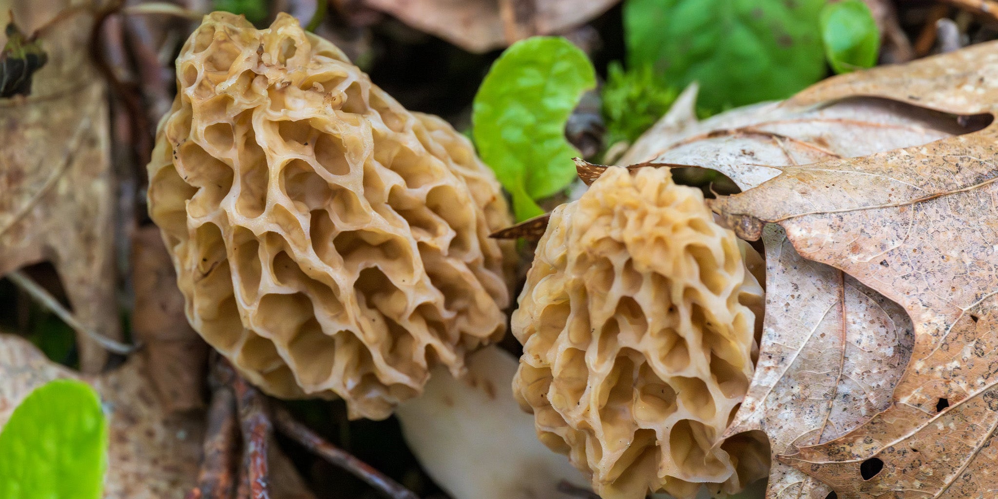
If you stand and look out from Mount Rigaud, you can appreciate the ephemeral nature of our current waterways, and how the trees and plants and wetlands of today are simply a product of the past recent geological events. The wildlife, flowers, insects and mushrooms we enjoy seeing today have certainly been here longer than us, but are still relative newcomers. And, of course, we want them to be here much longer than us.
By Chris Buddle, with support from Professor George McCourt (Geologist)Drone imagery by Thomas Leszkiewicz


